 1958 U.S. Army Intelligence / City Planning Map of Honolulu, Hawaii For Sale
When you click on links to various merchants on this site and make a purchase, this can result in this site earning a commission. Affiliate programs and affiliations include, but are not limited to, the eBay Partner Network.

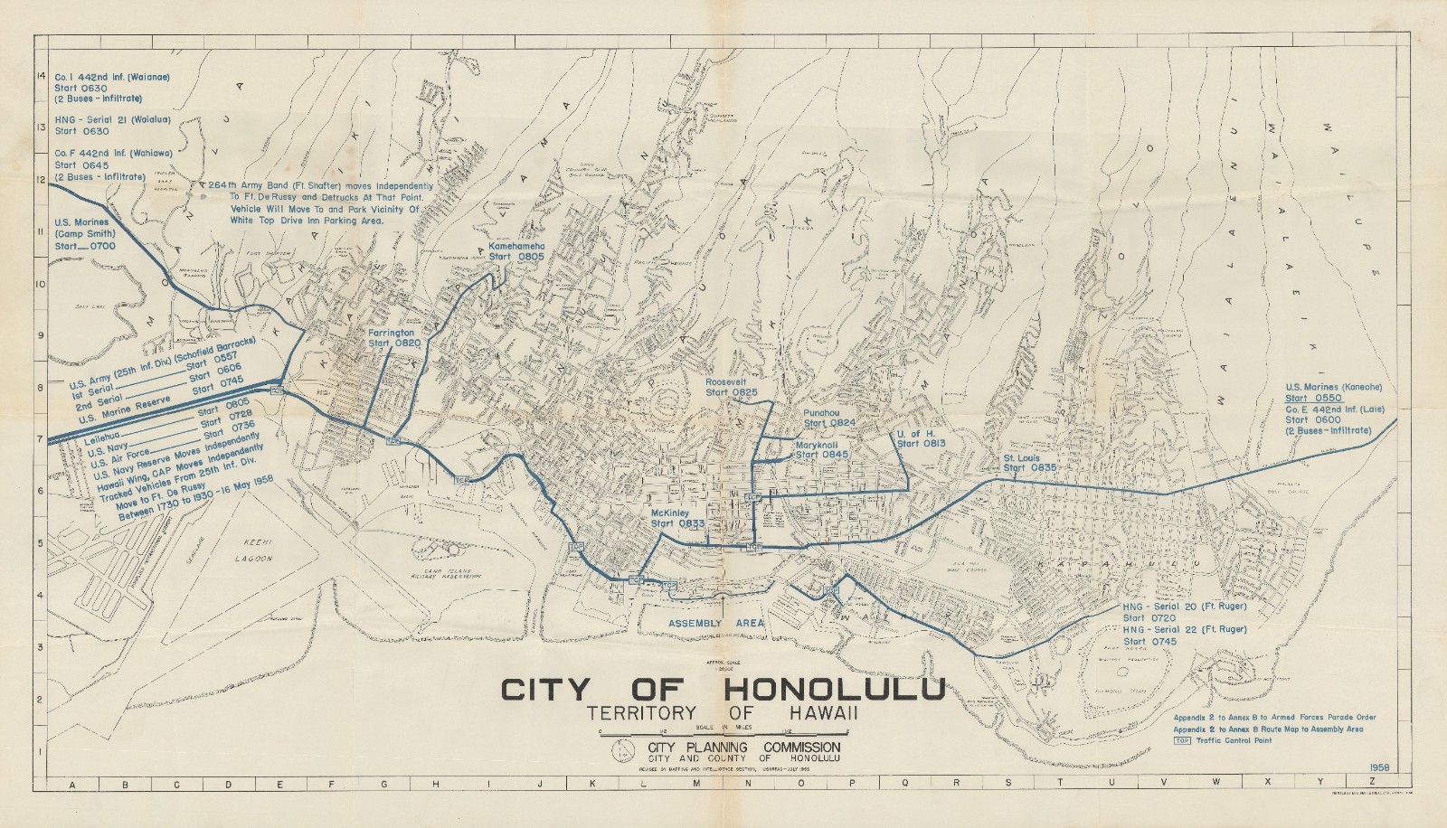
1958 U.S. Army Intelligence / City Planning Map of Honolulu, Hawaii:
$500.00
37 x 21.25 in. City of Honolulu. Territory of Hawaii. This is a curious large-format 1958 map of Honolulu, prepared by the Mapping and Intelligence Section of the USARPAC (U.S. Army Pacific). It is based on a 1955 City Planning Commission map of the city and was prepared for the Armed Forces Day Parade and related festivities in 1958. The map records street names, topography, railways, airports, military facilities, parks and golf courses, and public institutions. It is overlaid with blue print indicating the route of the Armed Forces Day Parade. It is notable that themap includes companies of the legendary 442nd Infantry, the highly decorated unit composed primarily of Japanese-American soldiers, which operated as an active reserve unit in Hawaii after WWII.
|
|
Other Related Items:
Related Items:
ZIPPO 1958 U.S.S. NEWELL DER 322 CHROME LIGHTER U432 $59.99
1958 U.S. Military Academy Yearbook Howitzer West Point New York NY $34.99
1958 U.S. Army Intelligence / City Planning Map of Honolulu, Hawaii $500.00
|