When you click on links to various merchants on this site and make a purchase, this can result in this site earning a commission. Affiliate programs and affiliations include, but are not limited to, the eBay Partner Network.
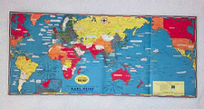
ORIGINAL WORLD WAR II DATED EVENTS WORLD WAR MAP
STANLEY TURNER, A.R.C.A. — ALLYN AND BACON
EUROPEAN AND PACIFIC WAR THEATERS — DOUBLE-SIDED
An outstanding original World War II-era pictorial war map created by Canadian cartographer and illustrator Stanley Turner and published by Allyn and Bacon, publishers of the Stull-Hatch Global Geographies.
This fascinating double-sided historical map features a colorful illustrated map of Europe, the Soviet Union, North Africa, and the Middle East, with a detailed black-and-white Pacific theater map on the reverse.
COLOR SIDE — WORLD WAR II IN EUROPE
The beautifully illustrated principal map documents wartime geography and major developments across Europe and surrounding regions.
Features include:
• World War II political boundaries and occupied territories
• Color-coded Allied, Axis, and other territories
• Wartime military and naval installations
• Illustrations of battleships, military aircraft, and other period subjects
• Dated events and historical annotations
• The Soviet Union, European countries, North Africa, and the Middle East
• Decorative inset maps, military symbols, and explanatory legends
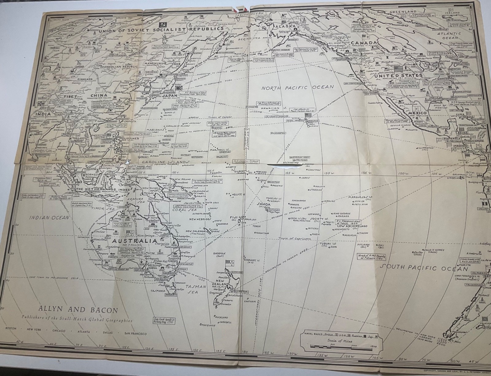
REVERSE — PACIFIC WAR THEATER
The reverse contains a detailed black-and-white map showing the vast Pacific theater, including Japan, China, Southeast Asia, Australia, New Zealand, the Pacific islands, and the western United States.
It features marked military and naval bases, strategic routes, geographic locations, and wartime annotations across the Pacific.
HISTORICAL SIGNIFICANCE
Stanley Turner's wartime cartography is especially interesting because his maps documented the progress of World War II through detailed geographical information, contemporary events, and distinctive visual design.
This original Allyn and Bacon publication offers a fascinating snapshot of the military and political geography of the Second World War.
An excellent collectible for enthusiasts of WWII military history, historical cartography, Pacific theater operations, European wartime geography, military aviation, naval history, and vintage educational maps.
Original period map, not a modern reproduction.
Please note that the map has visible tears, fold wear, and paper loss, as shown in the photographs. Exact edition and publication year remain unconfirmed.
One original double-sided map is included, as pictured.